Data Services
2D CAD/GIS Data Conversion and Migration
NSG India provides a complete range of Geospatial solutions and services in the world wide. Coord provide sophisticated GIS Applications and End-to-end solutions in Development of Geographic Information Systems (GIS) for Mapping, Telecommunication, Transportation, Engineering, Utility, Governments, Environmental Protection and Municipal GIS, Services ranging from regional base mapping to facilities conversion.
We have huge experience with complex data sets in the GIS related field, as well as in storm water management, environmental systems, and health research. In all of these areas, our Geographic Information System (GIS) specialists and software engineers design and implement custom solutions for collecting, processing, analyzing and R&D reporting on system information.

Our Services Include
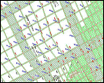
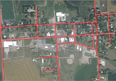
AM/FM Utility Mapping
The core service is provision of mapping solutions for the utility industries like Gas, Electricity, Water Supply, Transport and Telecommunication. We specialize in utility mapping which consists of many different services including full system digitization, system modeling, land base creation, revisions, work order updates, circuit map creation, raster to vector map conversion.
GIS helps utilities better organize, manage, and display data, and in turn help them better meet customer needs. GIS can help predict where potential growth and development may occur and where an expansion of utility services may be warranted. We can add utility information to your digital base plans and design drawings.
Advantages of Utility Mapping (Water, Gas, Electricity and Telecom)
Water, Gas, Electricity and Telecom utility mapping is designed to capture respective networks including all elements as per dimensions. It gives real positioning of the network.
- Application based on industry standard platforms using AutoCAD/Micro station and MS Access
- Integration with Customer Information systems
- Integration with Operations Support Systems (OSS)
- Cost Estimation
- Inventory Management
- Link to billing system data to calculate loads.
- Fully customizable to each utility.
- Utility easements tied to Government Land Office (GLO) corners provide reference to where the utility was built in the field.
- Utility structures reference visible map features for quick and accurate field location by in-house maintenance staff and/or other organizations requesting utility location information for design or construction use.
- Integrity rules built into commands to enforce correct representation of electric network.
- Network analysis to perform connected systems (primary and secondary, connected, upstream and downstream).
- Maintain inventory databases of electric system.
- Attach images of utility poles, meter locations and built.
- Custom label creator of all circuits and components.
- Thematic mapping of primary and secondary networks.
- Create map books of electric systems.
- Designed for smaller utilities, cost effective approach for mapping electric system.
- Plan, design and engineer Network and expansion
- Facility layouts, equipment placement and port-to-port connectivity
- Repository of As Built and survey data
- Provide network data to OSS / BSS systems
- Answer service activation / provisioning queries
- Cable fault localization
- Several Sales, Marketing and Service fulfillment related functions
Municipal GIS
Municipal GIS is a system which manages various tasks of a municipality such as Property Tax, Birth and Death Registration, Socio Economic Data management and Holding registration. This also shows the geospatial view of the current municipal area linked with the corresponding database.
Municipal GIS will largely address the needs of various local government departments such as Local Administration, Public Works & Engineering department, Public Health Department, Water supply, Town and Country planning Department, Public Safety, Land records, Tourism Department etc.
Computerization involves design, creation, implementation and maintenance of a stable spatial database linked to the database, which will be used on a day-to-day basis. The whole process is continuous and not static. There can also be a provision of linking each individual plots with their digital photographs, and a link to the Map showing the location of the plot.
Advantages of Municipal GIS
The database possesses attributes of each individual property with information such as land owner, co-owner, mailing & permanent address, house style, built year, individual room measurements, land use, type of construction, neighbourhood area, compliance with the regulations of the building authorities, public / private utilities mapping to the plot, street characteristics and amenities. Systematic planning for cost-effective infrastructure investment and improved service provision & maintenance Property Tax Assessment Computerization of land records
- Determination of assessed and un assessed properties
- Digitization of existing spatial entities such as base maps
- Updation of property records
- Infrastructure database creation
- Survey of the individual properties
- Updation of the non-spatial database on a day to day citizen centric level
Mining
The mining solutions are based on sound understanding of geological concepts and the systematic use of appropriate mapping techniques and tested quality processes to suit different requirements.
The key to success lies in understanding the cyclic nature of most businesses within the geologically oriented industries, whereby quick production turnaround and quality are critical.
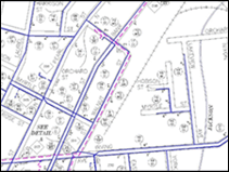
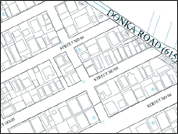
Landbase Mapping
NSG India offers services for the development, implementation, and maintenance of land information systems, including system design, data Modeling, data conversion, and data migration.
Land mapping solutions are essential for planning and development. Land Mapping solutions focus on land records and details of their database. These tools support the decision making and analysis.
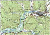
Topographic Mapping Services
NSG India Topographic Mapping Services usually portray both natural and manmade features. They show and name works of nature including mountains, valleys, plains, lakes, rivers, and vegetation. They also identify the principal works of man, such as roads, boundaries, transmission lines, and major buildings.
The wide range of information provided by topographic maps make them extremely useful to professional and recreational map users alike. Topographic maps are used for engineering, energy exploration, natural resource conservation, environmental management, public works design, commercial and residential planning, and outdoor activities like hiking, camping, and fishing.
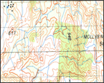
Contour Maps
Contour mapping is the system of connecting isopleths lines that depict several weather related integrals. Isopleths stands for equal valued lines. This data is measured in account from the weather stations.
Important measurements to forecast the weather are moisture content, winds, clouds, fog, precipitation, pressure and temperature. These measurements predict the future atmospheric traits.
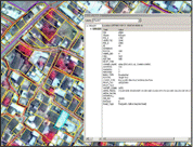
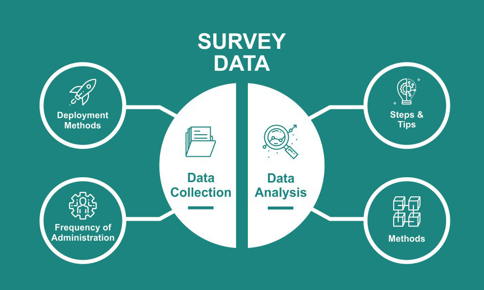
Survey & Data Collection
NSG India Systems executes precise and accurate surveying techniques using high accuracy surveying equipment to deliver engineering quality drawings, maps and it gives full control over data collection, stakeout and analytic reports, with colour maps displaying results in real time as you measure. This includes land survey, contour survey, utility survey and survey of natural resources in land and at sea.
- Surveying of existing geographic features
- Attribute Collection
- Feature Extraction as per project requirements.
- Geometrical correction / updations of land base features wherever required.
- Digitization of existing electrical network, assets with their internals, SLD and latest data captured from field.
- Coord GIS software adds intelligence to spatial data, whether the data is generated in the field with GPS or remotely with photogrammetry. DGPS and kinematic mapping of Spatial and Non spatial data collection using world class Coord GPS equipments. We are experts in land survey, contour survey, utility survey, create maps, and transfer data at very fast pace and in the most efficient and scientific manner.
Type of the Survery work that We Conduct:
- Topographic survey
- Land survey, Contour survey, Utility survey
- Surveys using GPS and Total Station
- High precision survey using DGPS
- Pipeline & Transportation Network Survey
- Underground Locator survey
- Landbase Survey for Telecom Network Installation & Service Provisioning
- Digital Maps for Network Planning
- Telecom Network Survey
- Computerization of Outside Plant Assets
- Rural Network Planning
- Digital Maps for Limited Mobility (WLL) Service
- Customized Application Development
Photogrammetry
NSG India delivers the products and services in the photogrammetry field on-time and every time with the client's satisfaction having adequate experts in various kinds of applications. The art and science of accurately measuring objects on the earth surface from a series of overlapping photographs from aircraft or satellite. Photography describes the photographic principles involved in photogrammetry, while Metrology describes the techniques for producing 3-dimensional coordinates from two-dimensional photographs.
- Digital Aerial Triangulation
- Planimetry compilation
- Digital Terrain Modeling
- Digital Surface modeling
- Digital Orthophoto Generation
- Digital Vector data capture for International level of mapping projects with the ISO Standards
- 3D City modeling
- LIDAR data processing

NSG India professionals in Photogrammetry Services like Adjustment of the raw control data, Analytical Aerial Triangulation Control Processing, Photogrammetric Data Capture, Photogrammetric Data Quality Control, Photogrammetric Data Translation. We use of our relationships across the globe to have aerial photography and GPS Control done by in-country aerial mapping companies to client specifications. Our production facilities are equipped with both analytical and softcopy stereo-plotters.
Data compilation is accomplished in both Micro Station and AutoCAD on DATEM s IMA and Summit Evolution. We compile DEM / DTM and generate Contours and the Cross-sections. Sections are used for the design of highways, pipelines, and Power line rights-of-way etc for cut and fill planning. Coord Technologies uses PCI's OrthoEngine, Orthovista and socet set for ortho rectification of both scanned film and digital aerial photographs to produce map-quality ortho images.
Engineering Services
NSG India Engineering services cover the entire scope of Civil, Structural, Mechanical, Electrical & Plumbing (MEP) Engineering and Architectural applications. Our services include Drawing Conversion, Engineering Design drafting & detailing and Calculations. We provide Top-quality services to the Civil, Structural, Architectural, Facilities Management, Process & Energy, Utilities, Manufacturing, Transportation and Government sectors, on a multitude of platforms including Micro station, AutoCAD, Revit-Structures, StaadPro, X-Steel and other related software's.
- Structural Engineering
- Structural Civil
- Structural RCC
- Structural Steel
- MEP (Mechanical, Electrical & Plumbing)
- Architectural Engineering
- Oil & Gas Engineering
- Others

Structural Engineering
NSG India has a dedicated team to deliver Design and Detailed drawings of structural systems mentioned below as per ACI/BS/AS/AISC standards:
- Residential
- Commercial
- Institutional
- Bridges
- Industrial
- Others
Our services include Design & Detail Drawings and Bar Bending Schedules for all the above structures covering:
- All types of foundations including Pile caps and Raft slab
- Shear Walls and Retaining walls
- Columns
- Beams
- ResSlabs (Flat, Ribbed, Hardy, conventional and post tensioning)Identical
- Stairs and Ramps
- Industrial Structures & Machine Foundations (ISMF) (ISMFs require high precision and rigorous quality standards due to their scale)
Structural CIVIL
NSG India has a dedicated team to deliver Design and Detailed drawings for the following in Civil Engineering:
- Preparation of technical bid evaluation
- Preparation of Design basis and technical specification
- Structural layouts and sizing
- Design calculation reports and documentations
- Bill of materials
- 3D Modeling
- Drawing composition, extraction & checking
- Preparation of fabrication / shop drawings
- Plant As built
- Preparation of 2D drawings (General arrangement, reinforcement & detailed drawings)
- Preparation of underground piping drawings
Structural RCC
Our team with specific domain knowledge can deliver RCC/Steel design, detailed drawings including the Bar Bending Schedules for the following types of RCC/Steel Structures:
- High Rise Residential / Commercial Buildings
- Industrial Buildings
- Schools / Universities
- Embassies and other high security buildings
- Pump houses / Water tanks (over head and underground)
- Hospitals
Structural STEEL
NSG India offers the following STEEL detailing services for offshore structures: Steel Fabrication Drawings with Bill of materials for offshore structures for the following:
- Platform jackets (bases)
- Deck sections
- Deck facilities
- Production modules
- Drilling modules, quarters modules and Heli-deck (chopper deck)
- Oil and natural gas processing, transfer, and storage facilities
- Floating platforms and production facilities offshore floating terminals
- Fabrication Drawings
Mechanical, Electrical & Plumbing (MEP)
- HVAC (Heating Ventilating Air Conditioning)
- Plumbing
- Builders Work (BW)
- Architectural, Electrical and Fire Protection
- Piping / Pipeline & Plant Engineering
- Instrumentation & Electrical
Architectural Engineering
As-build drawings Bill of Quantities.
- Detail drawings / Shop drawings
- 3 D Modeling
- Furniture Layout Drawings
- Furniture Shop drawings